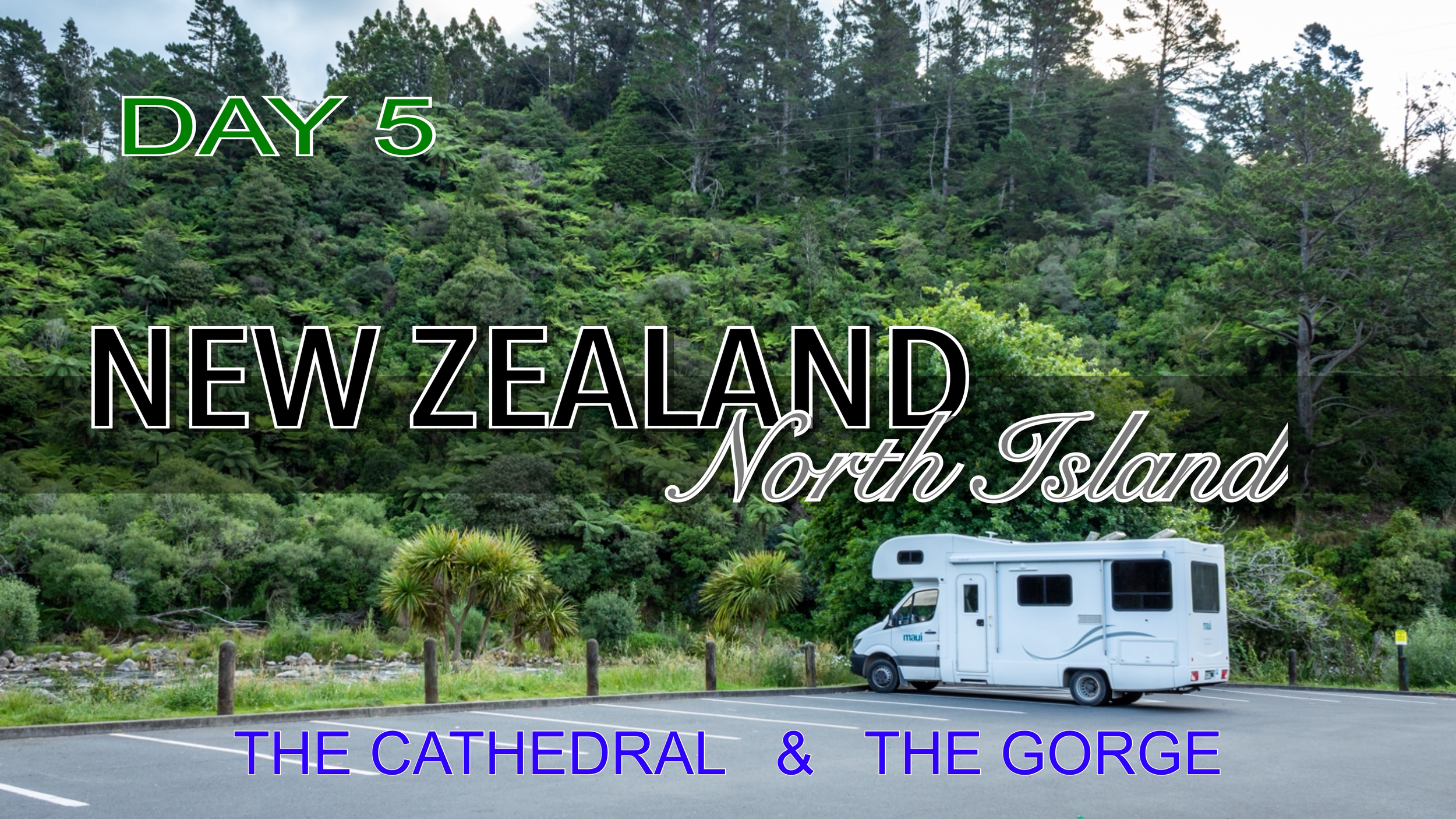
TONGARIRO ALPINE CROSSING
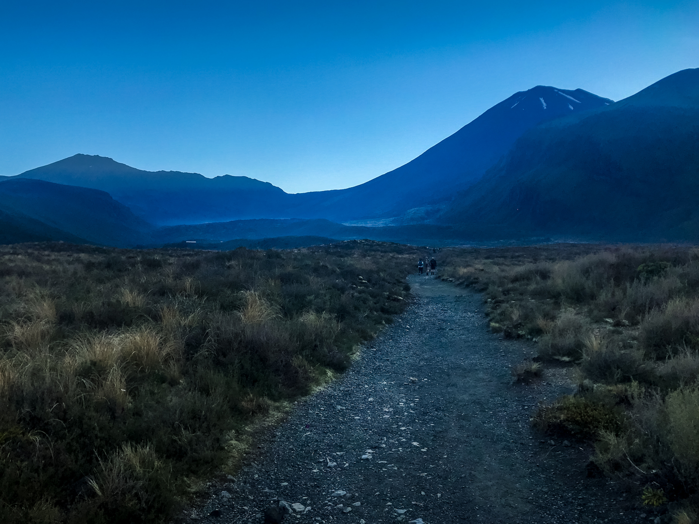
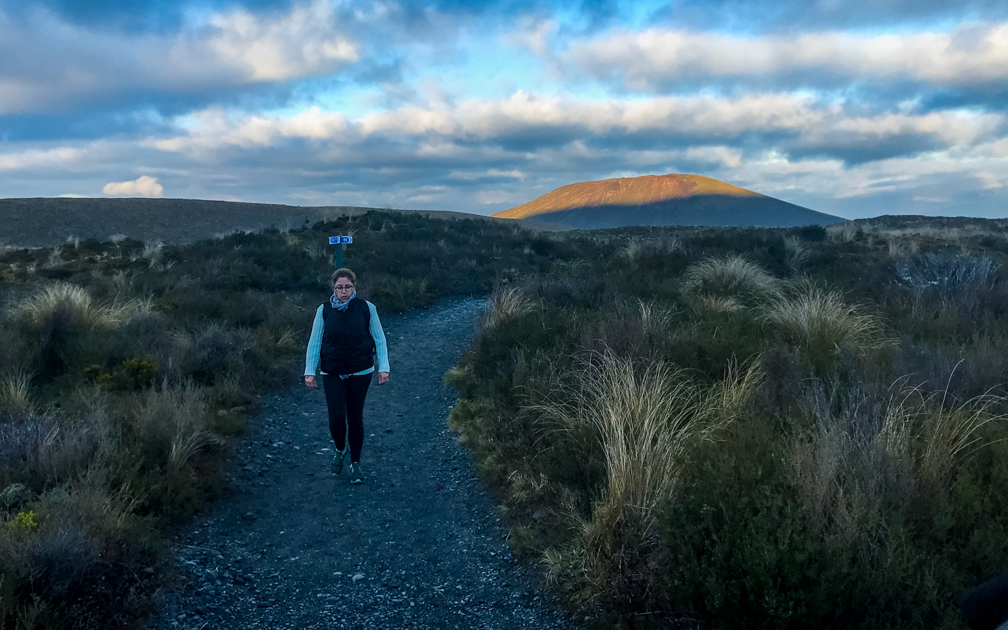
A very early morning start for day 10 of our New Zealand, North Island trip. We spend most of today hiking the Tongariro Alpine Crossing.
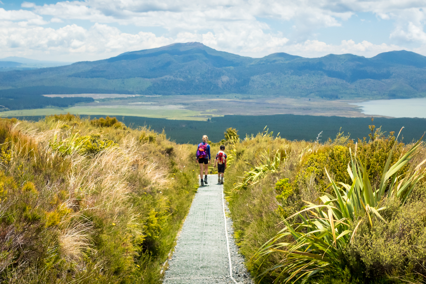
A 19.4 kilometre walk starting from the Mangatepopo carpark and ending at the Ketetaki carpark. It’s a 6 and a half hour hike that took us 7 hours to do. Which is pretty good considering I though it would take us a lot longer. Well a couple of hours longer anyway.
I think it was towards the end of blue hour when we started the easy walk through the valley. A small gradient for about 5 kilometres. A comfortable walk along a well maintained path that, not long after, becomes a raised wooden platform. All in the middle of low lying brush and small streams.
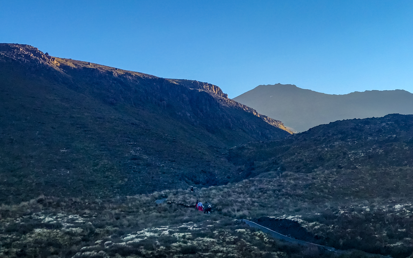
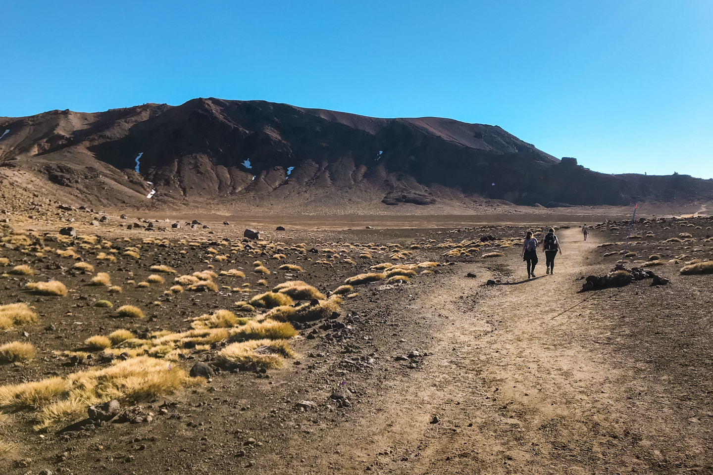
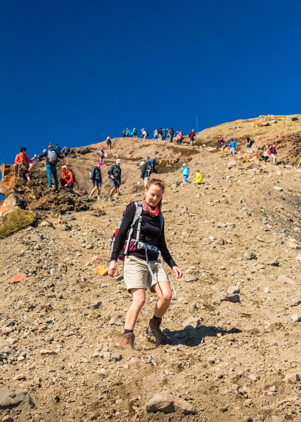
Then you arrive at a sign that asks if you’re sure you want to keep going because if you thought the last 5 kilometres were tough, the next 6 are a gruelling, constant uphill battle. And maybe you should think about turning back, now. To me it was the toughest part of the hike. You’re constantly walking up a steep hill and climbing stairs. A different environment from here on. Very rocky.

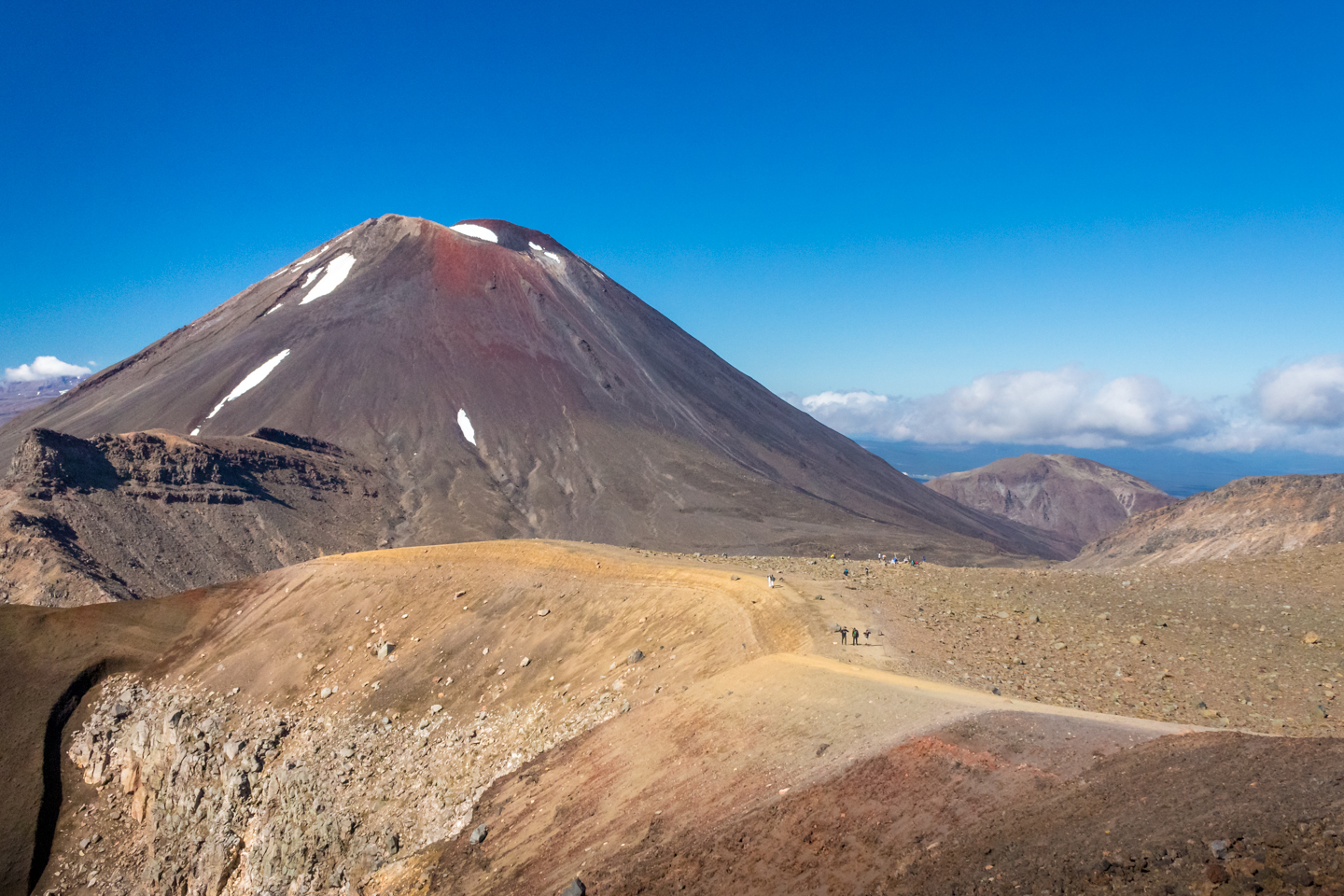
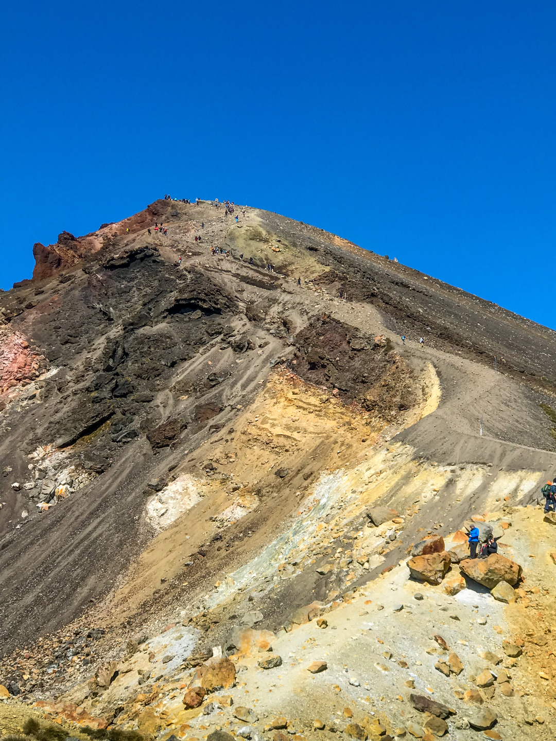
All worthwhile when you reach the top, not the summit, and see the grandiosity of the Red Crater. It reminded me of planet Mars. This is what it would look like, I thought to myself. We could clearly see Mount Ngauruhoe with it’s spots of snow. There were a few around the crater as well. The temperature had dropped a bit too.
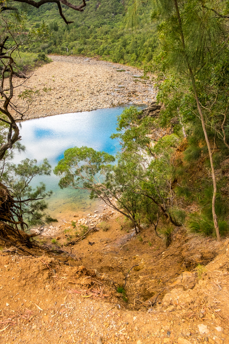
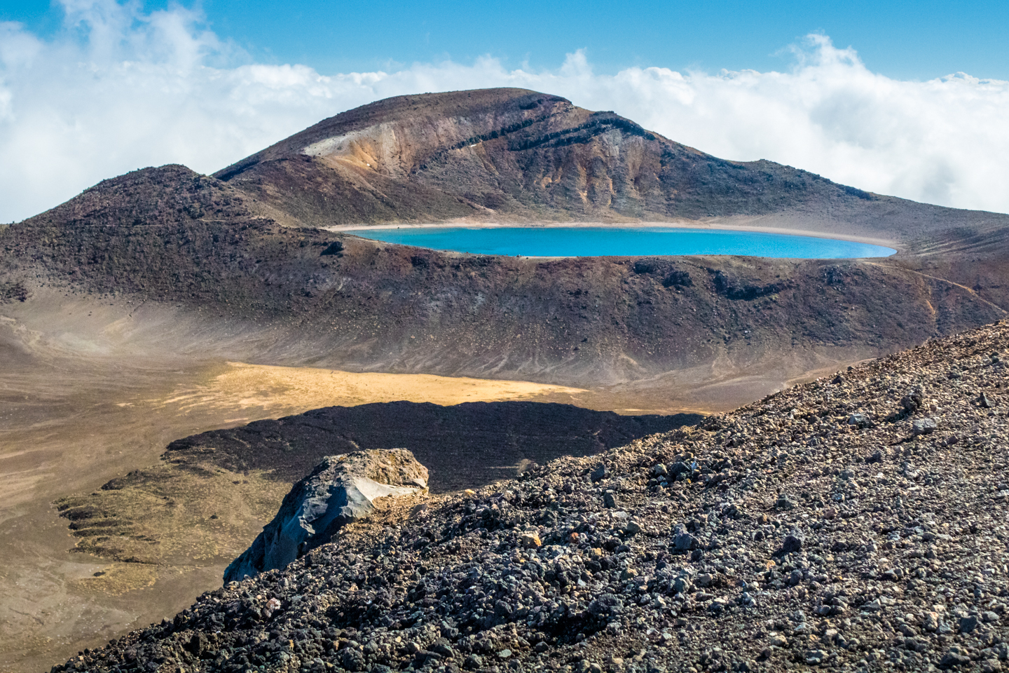
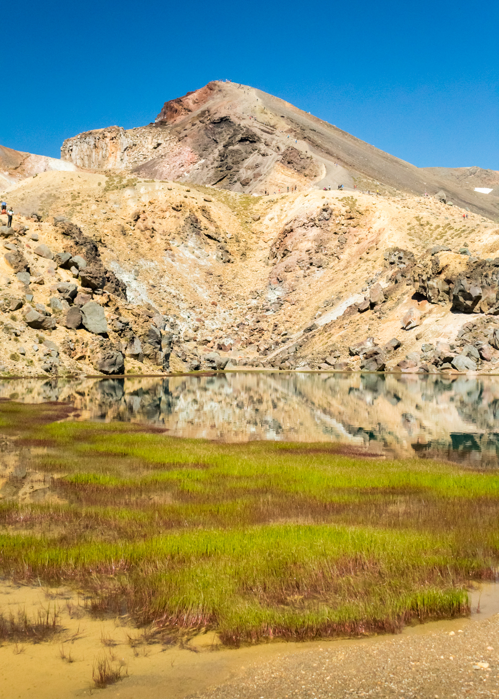
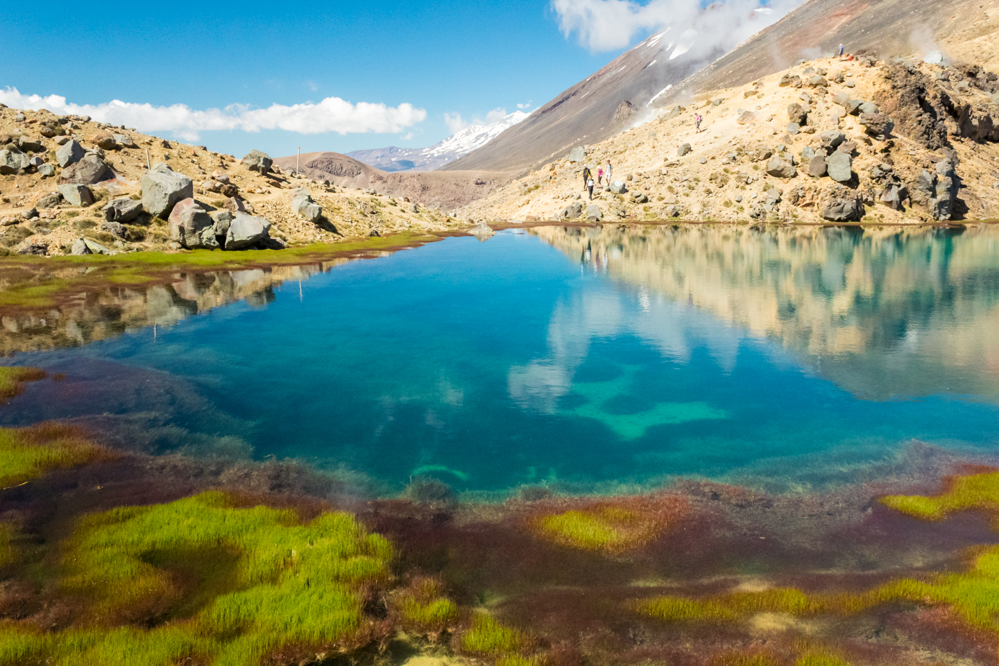
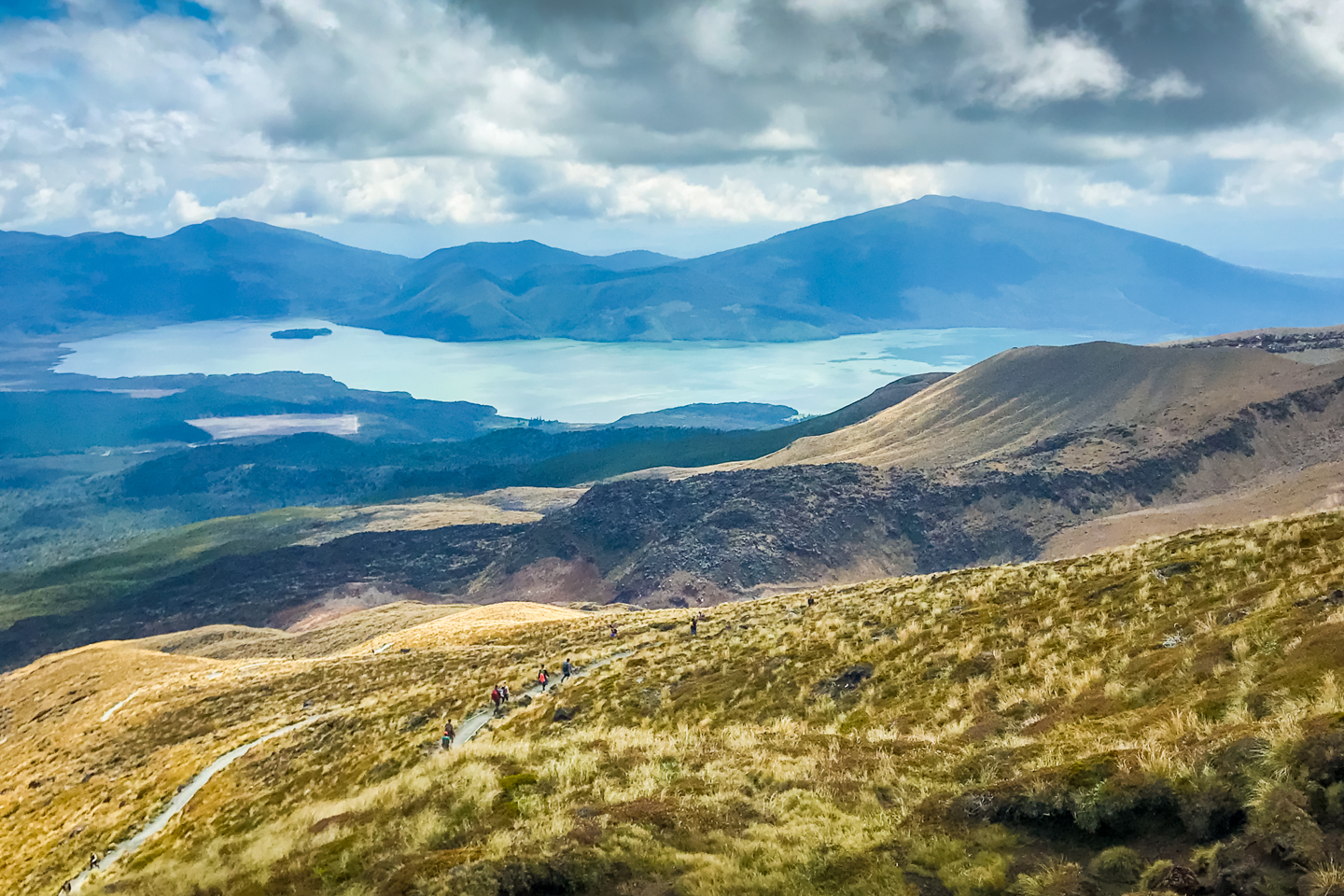
After the red Crater, Mount Ngauruhoe and the desert surroundings, we came to the beautiful sight of the Blue Lake. In my opinion more beautiful and impressive here, from afar, than up close.
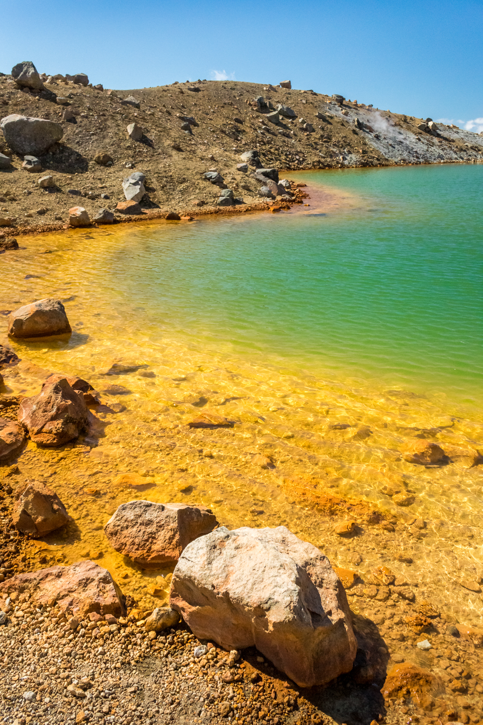
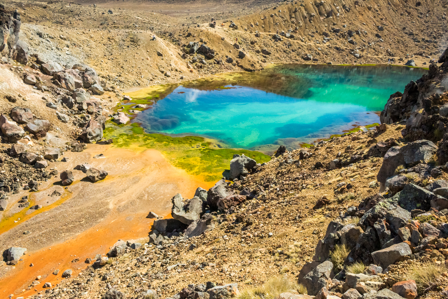
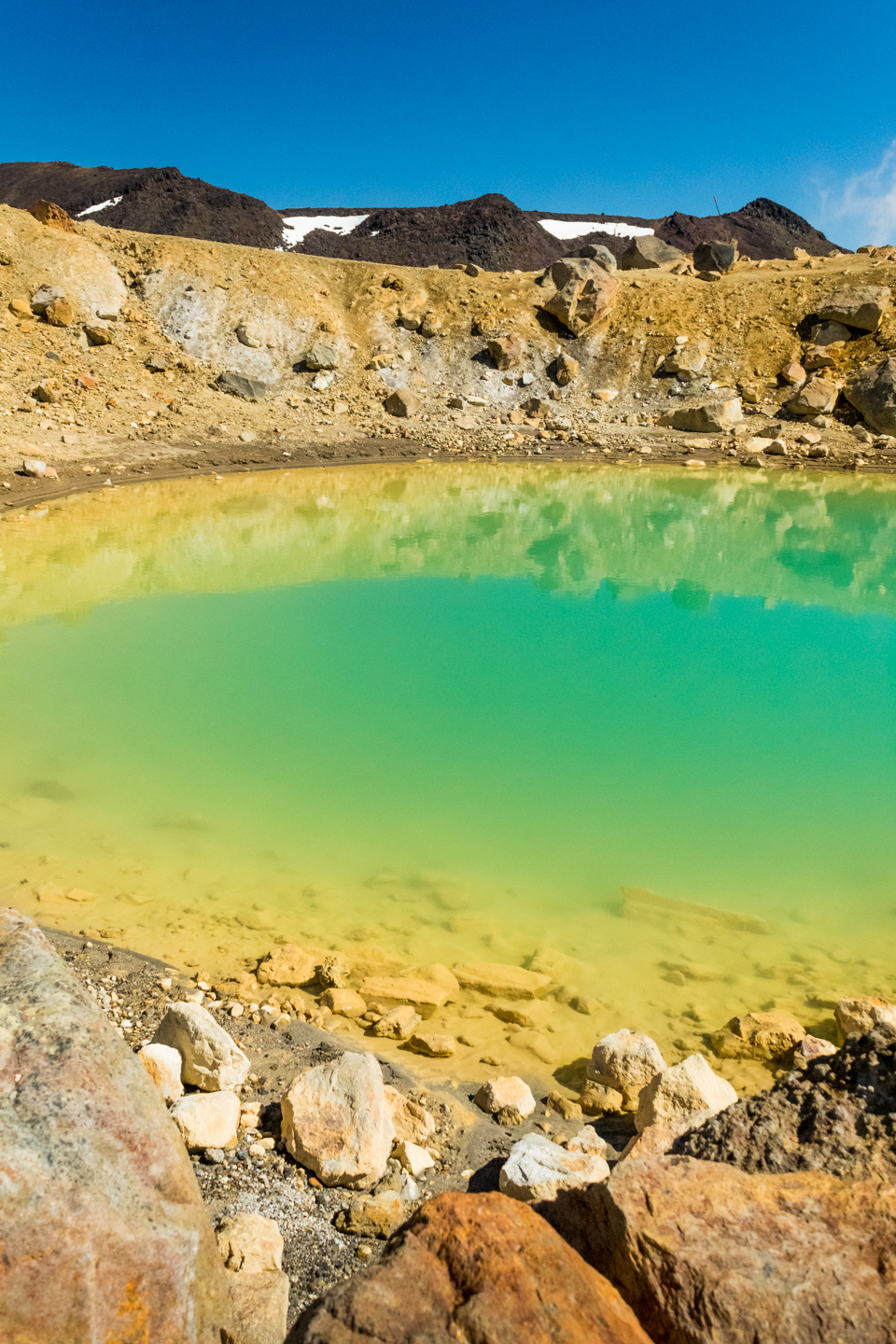
Another steep climb awaits but much shorter and slippery this time to reach the summit. Very windy and cold up here but my oh my what a gorgeous view. The Emerald Lakes are just majestic. So much so you tend to forget the 360º panoramic views.

The descent to the lakes is very steep and slippery with loose rocks and dirt. I saw 2 or 3 people hurt themselves from this descent. Ankles and knees get quite a beating here.
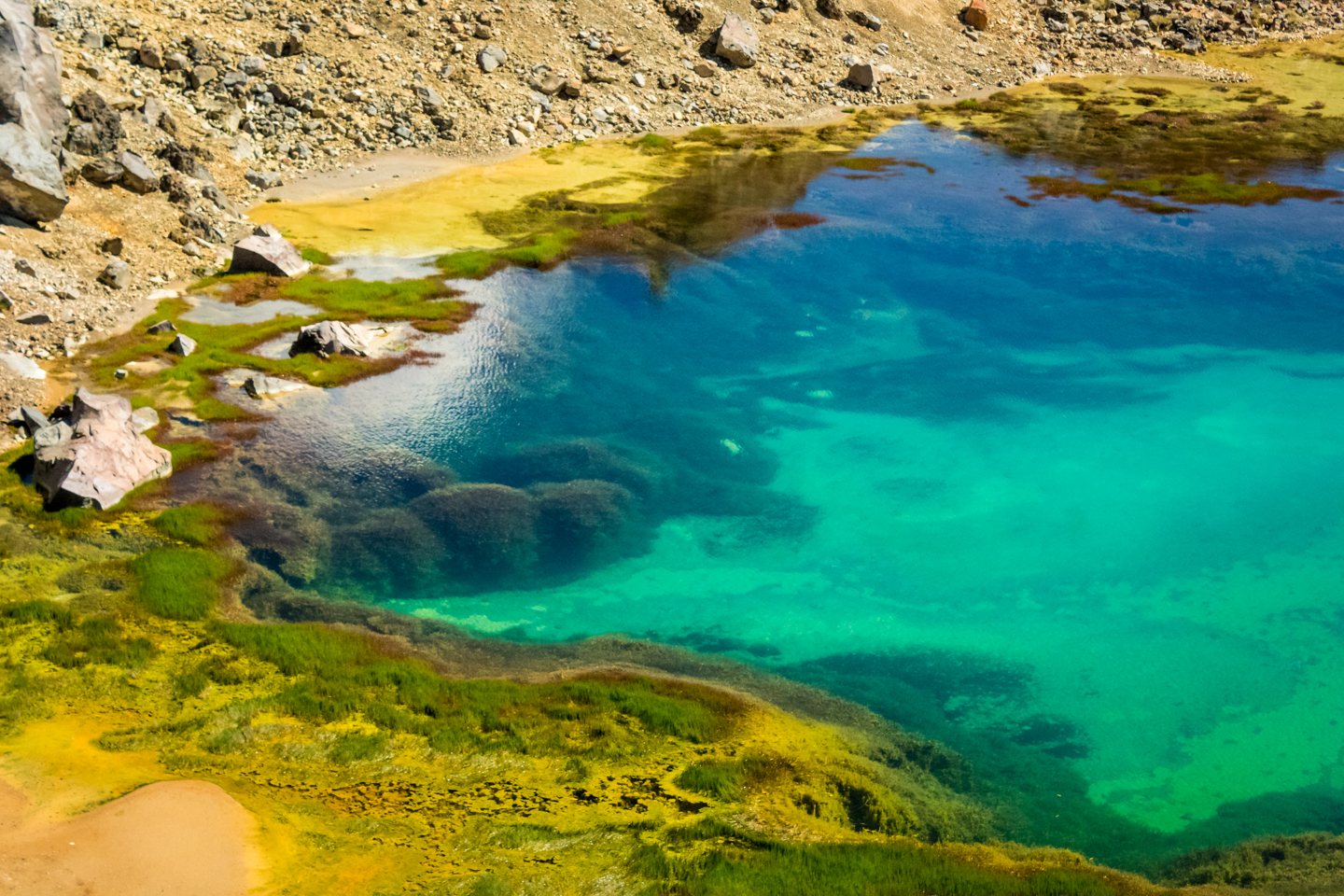
Once down you can get up close and personal to the three lakes. And they are just as impressive and beautiful right in front of your eyes. Each unique to one another in every way. Just amazing.
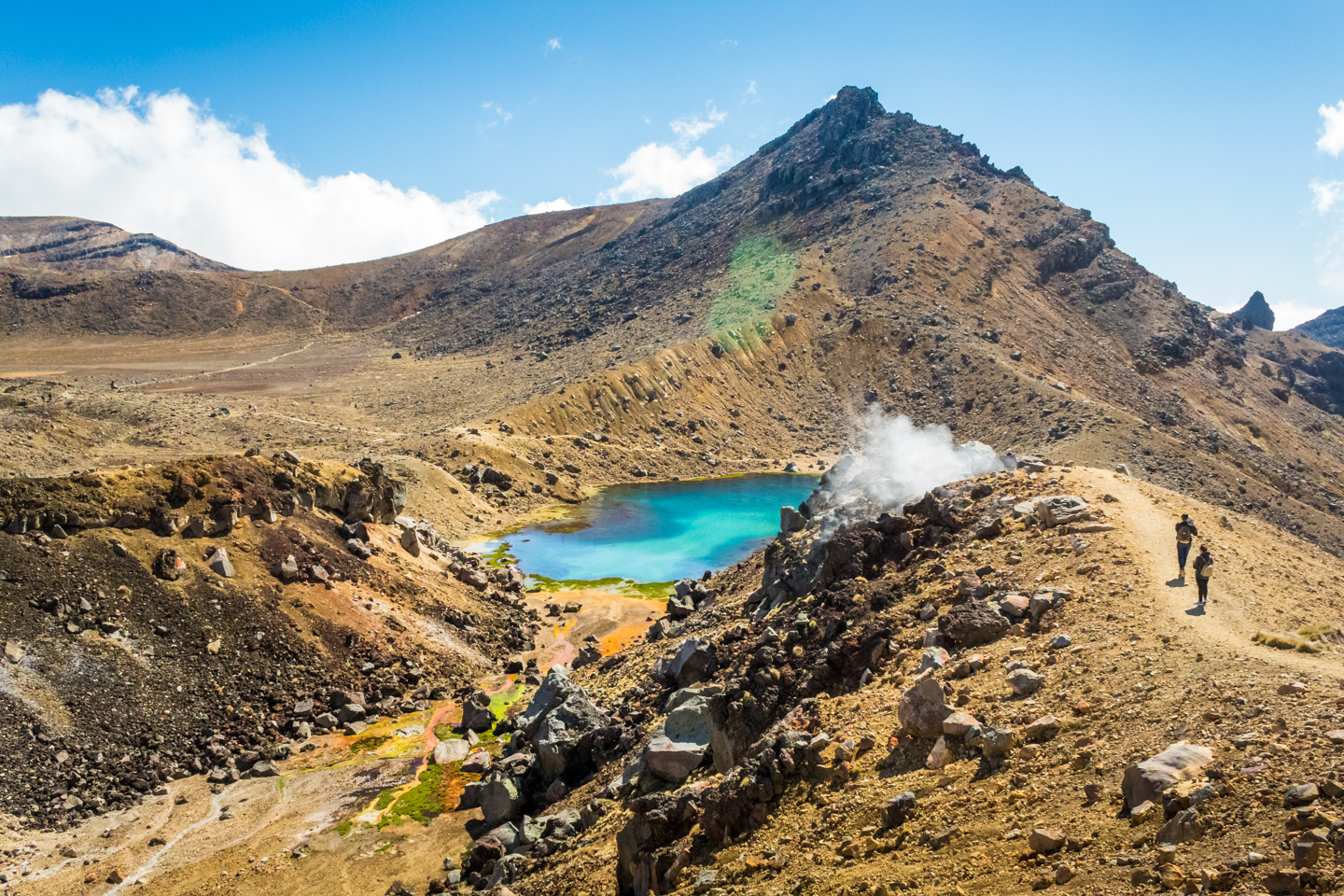
When you’re done admiring the Emeralds Lakes, you have the Large Crater to cross before reaching the Blue Lake.

The Blue Lake is much Larger than the three others and, as I mentioned before, less impressive up close than from afar. From here it looked like just another lake. From farther away you see it in it’s environment, surroundings, above the clouds and it makes you wonder, how?

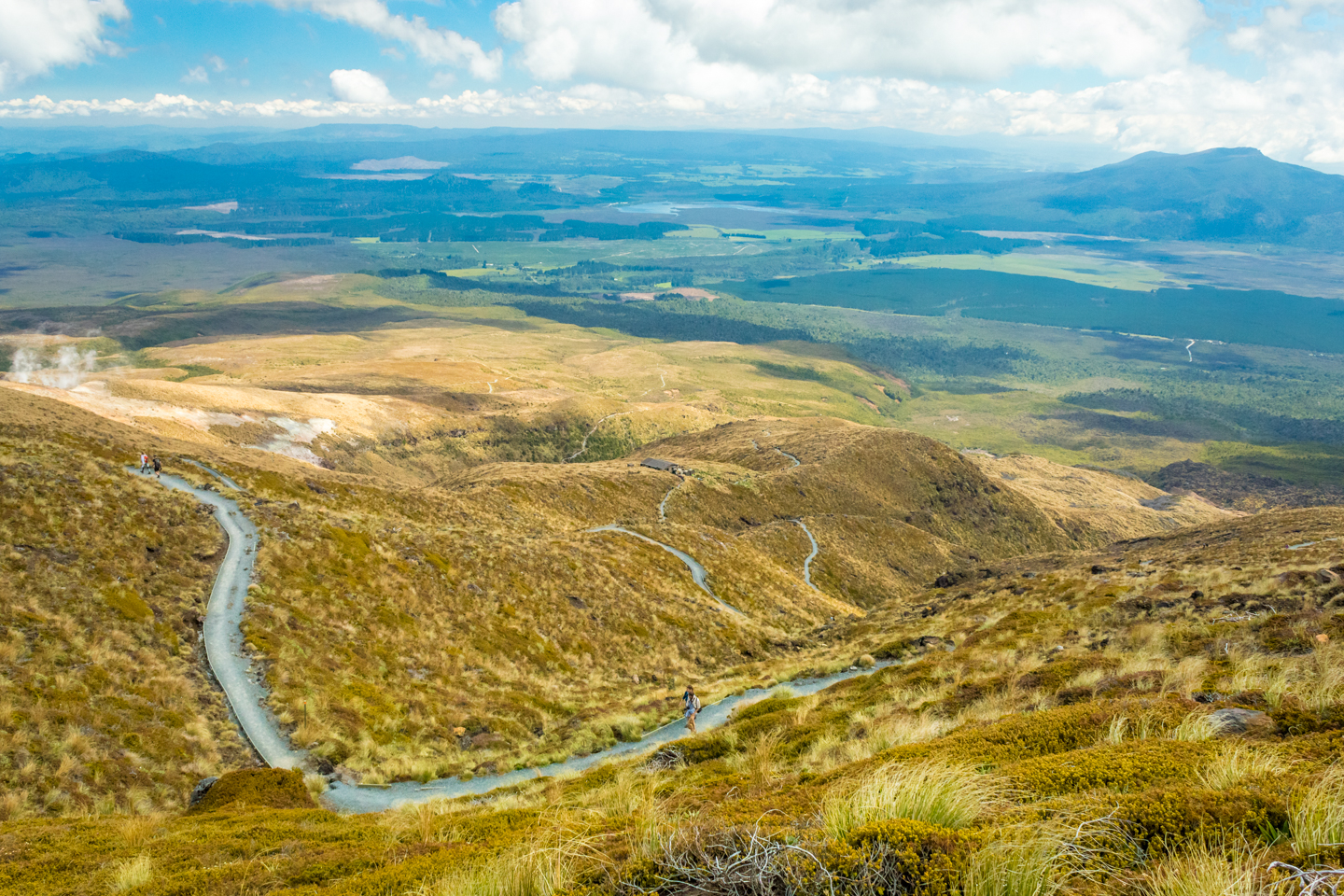
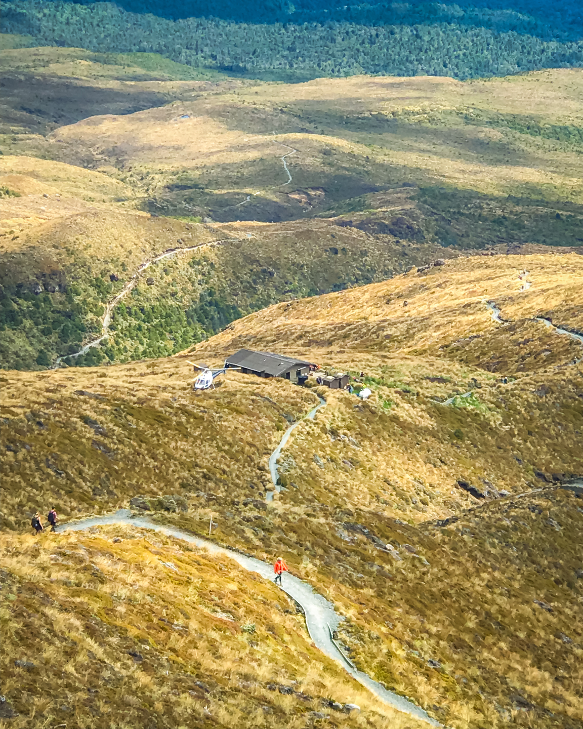
The terrain changes back from a desert to very rocky again. An easy going walk until we reached public toilets. There are a few of them every 5 or 6 kilometres. We had lunch with a view down the valley and a helicopter spectacle. They were dropping men and equipment to clean and empty the toilets. The speed at which they did it was quite impressive. No photos but we captured it in video if you want to check it out.

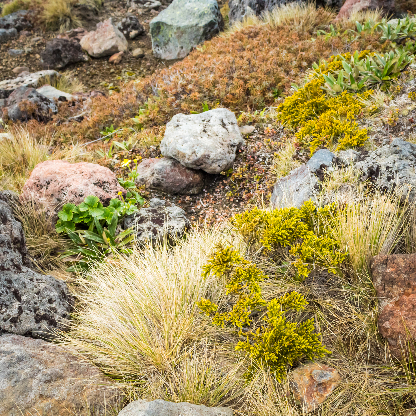
The environment changes again from here on to dry brushes and rocks and, if you look carefully, small, beautiful plants. Stunning views down the valley from here on too. I briefly met an old lady, perhaps in her 60’s, along this track. I don’t think it was her first time crossing the alpine.
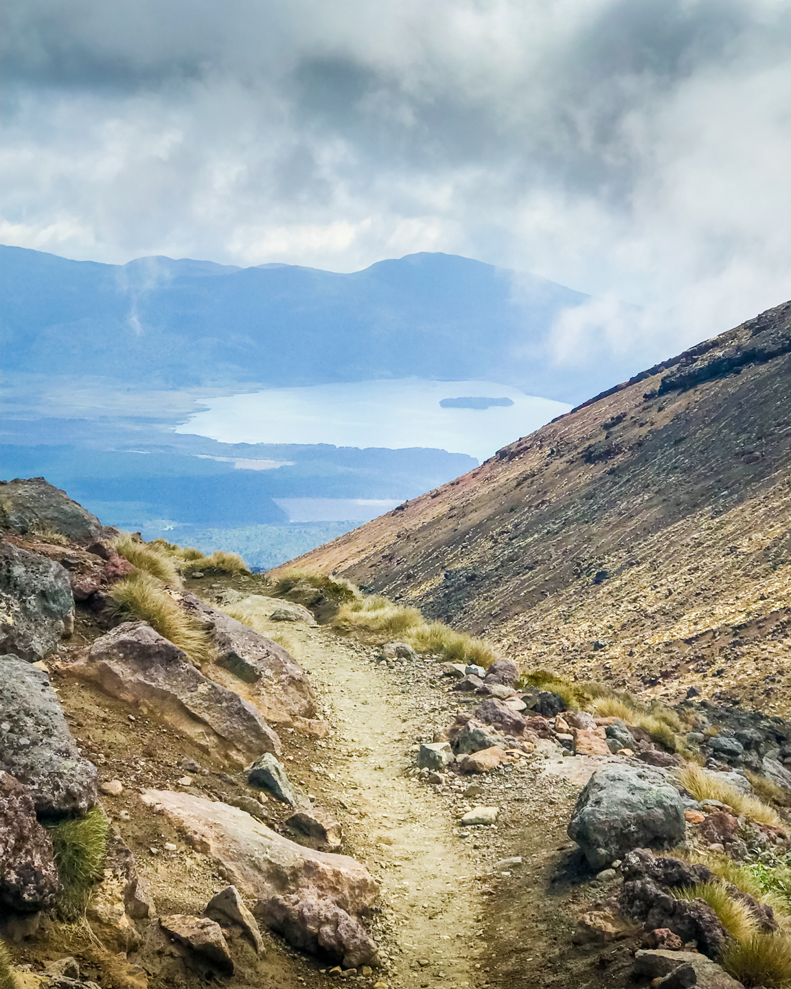
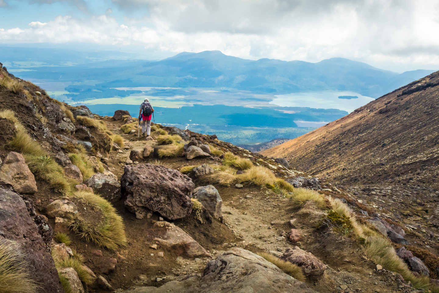
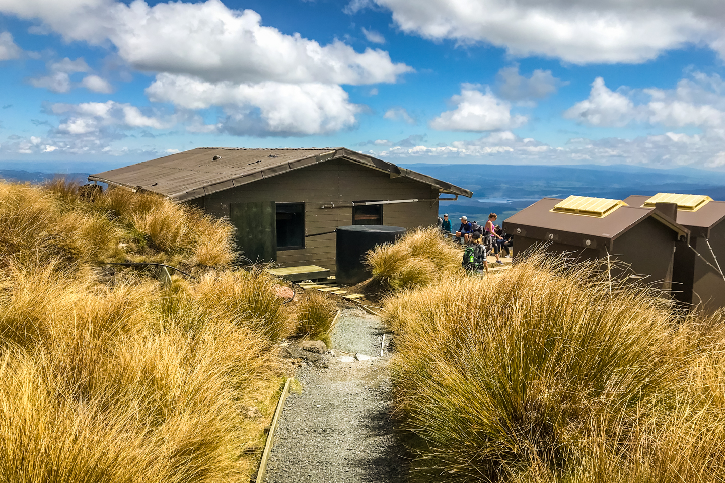
It’s all down hill from here on and the track become very well maintained. It wounds down to the Ketetaki Shelter where most people stopped for a bite, drink, rest and socialise a little. Between here and the forest I saw, for the second time, a young boy and his mother who were also doing the alpine crossing. The boy looked 10 years old. As I mentioned on my video post, young and old can do this hike.
So the forest is very welcoming as it’s the only time you find shade along the Tongariro Alpine Crossing. A little cooler too but very humid. I quite enjoyed the walk here. Nothing really picturesque to photograph apart this little cascade but, again, check out the video if you want to see what it’s like. Once you walk out of the forest, that’s it, you’ve arrive at the Ketetaki carpark. The end of the Tongariro Alpine Crossing.

We didn’t have to wait long before our shuttle bus arrived to bring us back to the Discovery Lodge Tongariro, where we stayed last night, for a nice shower and rest. We were going to stay the night too but felt pretty good and anxious to move on. So we packed up and left Tongaririo National Park. We drove a few kilometres towards our next destination before stopping at Taumarunui Holiday Park in Mananui for the night.
That’s it everyone until the next video. Tomorrow we head off to Waitomo to go underground.
p.s. thank you once again to Alain for the use of some of his photos.